Covered bridges are one of those quaint, neat historic things, that are kind of charming and kind of eerie at the same time. They are definitely fascinating, and few covered bridges in remain anywhere.
One of the covered bridges in SC that does remain is the Campbell’s Covered Bridge.
It makes for a nice little trip from Greenville, Spartanburg, Hendersonville, or even Asheville. It’s also a terrific highway stop over when traveling through upstate South Carolina.
The very neat Cambells Covered Bridge is open to the public and has a nice little park surrounding it. There are also some benches and historical markers explaining the site, in a pretty well done space for a fairly undeveloped area.
Susana and I stopped here on our way back from Greenville to Columbia after also checking out the very neat Poinsett Bridge, the oldest in South Carolina, that is located nearby. I thought it was definitely worth the stop.
If you’d like to see the Campbell’s Covered Bridge yourself, read on to learn about its history, what you can see there today, and how to get there.

*Disclosure: This post contains affiliate links, and I may earn from purchases made after clicking those links. Disclosure Policy.
Campbell’s Covered Bridge Guide – Contents
- History of Campbell’s Covered Bridge
- What You Can See at Campbell’s Covered Bridge Today
- Practical Tips
- How to Get to Campbell’s Covered Bridge
History of Campbell’s Covered Bridge
Campbell’s Covered Bridge, sometimes also called Campbells Covered Bridge, the Campbell Covered Bridge, or just the Campbell Bridge, was built between 1909 and 1911.
It was one of at least 20 known covered bridges in South Carolina.
However, it is the only covered bridge in South Carolina remaining today.
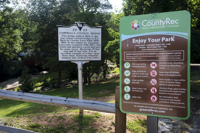
According to the historic markers at the site, the covered bridge was built after a smaller, flat bridge further upstream was wiped away by flood waters in a massive rain storm in 1908. That bridge had replaced a ford used to cross from earlier times.

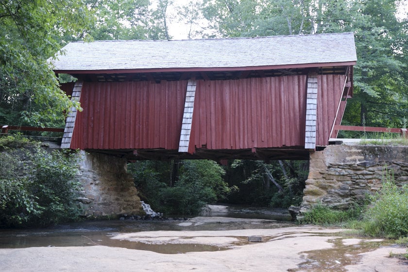
The bridge is 35 feet long and 12 feet wide, and it crosses Beaverdam Creek.
It was built by Charles Irwan Willis and named after Alexander Lafayette Campbell, who owned and operated the corn mill nearby and land the bridge was built on.
The bridge was built using pine timber and features a relatively rare four-span Howe truss design.
Willis placed the truss ends to follow the natural lay of the land, which gives the bridge and its supports a somewhat unique shape.
The bridge was restored in 1964 and again in 1990. I was very surprised to read on the signs that although Pleasant Hill Road was rerouted to avoid the bridge in 1951, it remained open to local traffic until 1984.
The Campbell land at some point passed to Joseph Daniel Smith, who built another corn mill nearly adjacent to the bridge in 1938. This mill was powered by a dam just upstream of the bridge.
According to the signs, the area was popular not only to hang out while grinding your corn but for special events and picnics.

One resident felt particularly strongly about preserving her memories there.
Stella M. Atkins supposedly fell off her mule into the creek as a young girl while visiting the Campbells’ daughters. She remembered fondly how the family helped her clean up before going home.
In 1975, she bought the property from the Smith family to ensure the area’s preservation.
In 1991, she passed the land with the bridge on to her granddaughter Sylvia Pittman, who according to family lore also fell into the creek at the age of 12, just like her grandmother.
Pittman sold the bridge and surrounding 18 acres to Greenville County in 2008 to ensure its preservation for perpetuity, and it was turned into a county park.
In 2009, Campbell’s Covered Bridge was added to the National Register of Historic Places.
What You Can See at Campbells Covered Bridge
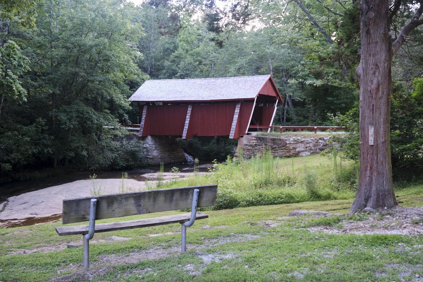
The main attraction here is undoubtedly the bridge itself. You’ll get a great glimpse of it through the trees from the parking lot.
You can either head down the little stairs to the remains of the mill, or walk along the gentle slope of the former road itself down to the bridge.

While it’s closed to vehicles today, the bridge is open to walk across.
It was neat looking up at the rafters. Even though I imagine much of this wood is not original, it still looks old and the restoration work certainly seems well done.
While definitely not as eerie or creepy looking as the stone Poinsett Bridge, I can understand why some claim Campbell’s Covered Bridge in SC is haunted.
On the far side, you can walk down to the creek where there is a little clearing along the bank. It’s worth walking down here to get a unique angle of the bridge. This also looks like it would be the best place to stick your feet in the water.

I thought we got a better view of the underside of the bridge and its supporting beams when we crossed back over to the near side and walked down along the bank in front of the mill. The larger rock there makes it easier to get a little closer.
Unfortunately, someone had sprayed some graffiti on part of the stone wall underneath. Please don’t be that guy! It was pretty neat seeing parts of the big iron supports and wooden beams. When you look at the bridge as a whole, it almost looks like it’s barely resting on the edges.
I’m no expert on civil engineering, but it seems like an impressive design.
This side is also where you’ll find the historic signs explaining the history of the bridge, including an explanation of its design.
Between the bridge and parking lot, you’ll find the remnants of the corn mill along with some markers explaining the history of it and Atkins’s purchase of the land.
There are a few benches and a couple picnic tables here too. It would definitely be a good spot for a picnic.
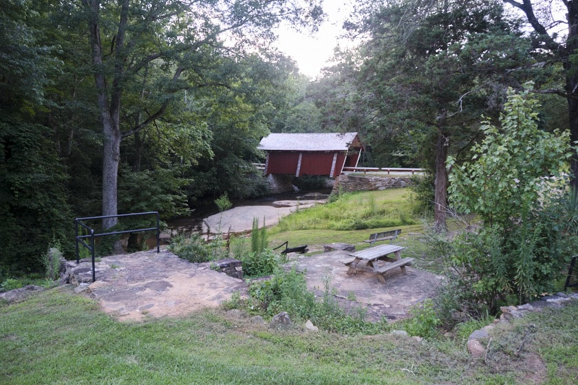
We noticed some kids leaving when we arrived that had taken a dip in the creek, but there were not any changing or bathroom facilities, so keep that in mind if you do decide to go for a little swim.
Really though, I think this is just a good chance to see a unique place while you stretch your legs and get a bit of fresh air if you’re passing through this area.
There is also supposedly a nature trail that is just a bit under a mile long.
We were just stopping by to see the bridge before heading back to Columbia, so we didn’t hike it. I would imagine based on the distance and area it is probably a pretty easy hike with maybe just a tiny bit of incline.

Practical Tips for the Campbell Covered Bridge
The bridge is operated by Greenville County Parks. There is plenty of parking here, but the area is closed at night.
Hours differ slightly depending on the time of year. According to the sign when we visited, during the spring and summer (April-September), it’s open from 7 am to 9 pm. During the fall and winter only until 7 pm.
That more or less translates to until dark, so do keep that in mind. There is a short write up but not a lot of info on the park at the Greenville CountyRec site.
I would say if you plan to spend a bit of time here or do the hike, having along some bug spray is a good idea, especially in the summer time.
Also, keep your eyes out for snakes like always in the woods near water in SC.
Finally, on our way to I-26 from here, we did have a deer run out in front of us not too far down the road in front of us.
Luckily, it was far enough ahead to not be a close call, but it did give us a bit of a fright, especially since some of the highways around here do have a pretty high speed limit of 55, and I had a guy tailgating behind me who wanted to go considerably over the speed limit. Don’t be that guy either, please.
And do keep your eyes peeled on the road.
As noted above, I didn’t see any public facilities or bathrooms here, so you may want to make a pit stop before coming the the Campbells Covered Bridge.
How to Get to Campbell’s Covered Bridge
While the official address of Campbell’s Bridge at 171 Campbells Covered Bridge Rd is listed as in Landrum, SC, it’s actually closer to the aptly named Campobello and just north of Greer and Taylors.
It’s fairly convenient from both Greenville and Spartanburg as well as from the nearby Poinsett Bridge.
I’ll go through a few directions to Campbell’s Covered Bridge below that should just about cover anyone who wants to come here themselves.
Hot to Get From Greenville to Campbell’s Covered Bridge
It should take between 30-45 minutes to get to Campbell’s Covered Bridge from Greenville.
There are two possible routes that should take just about the same amount of time, save a few minutes difference.
The first option is taking Wade Hampton Blvd and Hwy 14. This is definitely the best way to go if you’re coming from near the Greenville Airport or from near Taylors or Greer. It’s also the easiest route from downtown Greenville although the other might be a hair faster.
You’ll head out of downtown Greenville on Wade Hampton Boulevard until just past Taylors. Then, you’ll want to veer left to get onto Fairview Road and then turn slightly left onto S-23-171 aka N Rutherford Rd.
That will take you up to N Hwy 101, where you’ll want to turn left. A little over 2 miles later, you’ll turn right onto Berry Mill Road then a little under 2 miles later, left onto SC-14 W.
You’ll need to turn left onto North Reid Street after about 4 and a half miles, then head left on SC-414 W. After that, you’ll take the first left onto Pleasant Hill Road (what a great name by the way!).
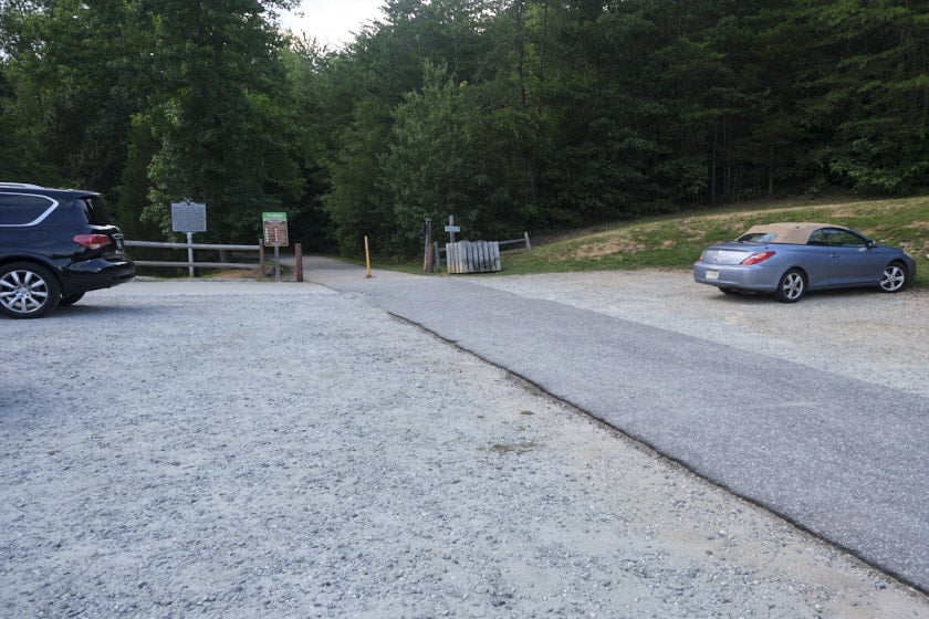
You’ll take the first right (watch out for a private drive just before), into the parking area of Campbell’s Covered Bridge. There is a little brown sign with an arrow that says bridge next to the parking lot.

The other route out of downtown Greenville is to head up North Main Street where you’ll merge right onto S-23-21 aka Rutherford Rd. You’ll then need to take a left onto Piedmont Park Rd. That will take you up to where you’ll need to veer right onto SC-253 aka E Mountain Creek Rd.
You’ll stay on SC-253 for about 6 miles before needing to turn left to continue on what is still SC-253. Then, you’ll turn right onto Fews Bridge Road. Next, you’ll turn left on N Hwy 101 by a dollar store, and then take the first right onto Donahue Road.
You’ll take a right as you go around a curve onto Pleasant Hill Road, which you’ll follow until you see the parking area and bridge on the left.
From Spartanburg, Columbia, and I-26 W
There’s actually a few routes you could take from Spartanburg to Campbell’s Covered Bridge, but in the name of simplicity and accounting for people coming from the midlands or elsewhere in central/south east South Carolina, I’m going to only go over the route via I-26 W.
You’ll want to take exit 5 for SC-11 towards Chesnee/Campobello. Turn left onto SC-11 S. You’ll follow that for around 7 and a half miles before you’ll need to turn left onto SC-14 E. Next, you’ll turn right on SC-414 W.
Finally, you’ll turn left onto Pleasant Hill Road and the bridge will be on your right.
From Asheville, Hendersonville, or I-26 E
If you’re coming from the Smokey Mountains or beyond, you’ll be heading down I-26 E towards Spartanburg/Columbia/Charleston. From Asheville, it should take about an hour, from Hendersonville, about half an hour to get to the Campbells Covered Bridge.
Just across the SC state line, you’ll want to take exit 1 to SC-14 E just outside Landrum.
You’ll go right off the interstate onto SC-14 E passing through Landrum. You’ll need to turn right onto SC-414 W, then left on Pleasant Hill Road, and you’ll see Campbell Covered Bridge on your right.
From Charlotte
From Charlotte, it should take a little over an hour and a half to get to the Campbells Covered Bridge.
The easiest route is to take I-85 to Spartanburg then get onto I-26 W and follow the directions to Campbell’s Covered Bridge from Spartanburg above.

How to Get Here from Poinsett Bridge
As I mentioned above, this is what we did, stopping by Campbell’s Covered Bridge after seeing the Poinsett Bridge. They pair together well, both quaint and charming but also very different.
I tend to think if you’re going do do one of these historic bridges, you might as well go just a bit more out of your way to do the other too. Be sure to check out my guide to visiting Poinsett Bridge to learn more about what you can see there.
These directions are from Poinsett to Campbell’s Covered Bridge like in the order we did them, but you could in theory reverse them and go in either order.
If I was coming from the direction of either Greenville or Asheville, I’d do Poinsett first like we did. If I was coming from Spartanburg, Columbia, or further south I’d probably do the Campbell’s Covered Bridge first.

To get from the Poinsett Bridge to Campbell’s Bridge, you’ve got a few different options of routes. They all take 15-20 minutes.
Regardless of which route, you’ll want to turn right out of the parking area onto Callahan Mountain Drive. When you come to the fork, go left, then left again to turn onto Hwy 912.
At the intersection with SC-11, you can head straight to continue on to N Highway 101 or turn left on to SC-11 N.
If you go straight, you’ll need to then turn left onto SC-414, then right on Pleasant Hill Road, and the bridge will be on your right.
If you went left on SC-11, you’ll take a sharp right just past a curve onto Dill Road. Next, turn left onto SC-414, where you’ll hang the same right turns on Pleasant Hill Road and then into the parking lot.

Ready to Visit Campbell’s Covered Bridge?
Campbell’s Covered Bridge is really a unique site and nice roadside attraction.
It’s absolutely worth making a little trip from Greenville, Asheville, Hendersonville, or Spartanburg to see it or using it as a great chance to stretch your legs and get some fresh air on a longer trip up or down I-26.
If you do go to see this little piece of South Carolina history yourself, I hope you found this guide useful, and that you enjoy it as much as we did.
Cheers and Happy Exploring!
Did you like this post?
As mentioned above, do check out my write up on the Poinsett Bridge too. Also, if you love history, the South Carolina State Museum and the Military Museum are worthwhile visits in Columbia, SC.